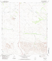
1983 Map of Buck Hill
USGS Topo · Published 1984About this map
Green Valley dominates the northern reaches of this Big Bend-area landscape, a region defined by arid basins and isolated peaks during the 1970s. The terrain transitions from the broad expanse of the valley into the elevations of Buck Hill and Butcherknife Hill, where water management is critical to ranching operations. Numerous water features, including Butcherknife Tank, Broken Tank, and an unnamed Drill Hole, indicate the infrastructure required to sustain life in this Brewster County environment.
Find a feature on this map
13 named features on this map. Tap any name to fly to it.
Don’t see what you’re looking for? This feature index may not catch every label — zoom into the map to look around manually.
Map Details
Editions of this 1983 Buck Hill Map
This is the sole edition of this map. No revisions or reprints were ever made.
Other maps of this area

1917 · Agua Fria
USGS Topo · 1:62,500

1917 · Santiago Peak
USGS Topo · 1:62,500

1917 · Buck Hill
USGS Topo · 1:62,500

1918 · Bone Spring
USGS Topo · 1:125,000

1918 · Buck Hill
USGS Topo · 1:62,500

1918 · Santiago Peak
USGS Topo · 1:62,500

1918 · Nine Point Mesa
USGS Topo · 1:62,500

1925 · Buck Hill
USGS Topo · 1:62,500

1937 · Nine Point Mesa
USGS Topo · 1:62,500

1937 · Agua Fria
USGS Topo · 1:62,500