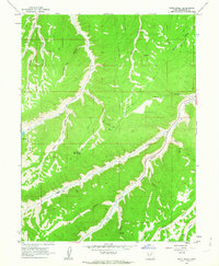
1962 Map of Buck Knoll
USGS Topo · Published 1963About this map
Indian Canyon and its many tributary drainages dominate this mid-century topographic study of Duchesne County. The landscape is defined by a complex network of high-elevation ridges and deep hollows, including Lake Canyon, Matilda Canyon, and Skitzy Canyon. Evidence of mid-century industrial activity is present in the form of the Raven Mine located south of the Right Fork Indian Canyon, along with scattered Oil Wells situated on the higher plateaus near Buck Knoll. The map details a primitive transportation network consisting primarily of an extensive system of Jeep Trails and unnamed roads that navigate the steep terrain between Wolf Den Hollow and Cottonwood Canyon. Water sources are sparse but noted, with Cripple Creek and various Springs providing essential landmarks for the era's surveyors and prospectors.
Find a feature on this map
27 named features on this map. Tap any name to fly to it.
Don’t see what you’re looking for? This feature index may not catch every label — zoom into the map to look around manually.
Map Details
Editions of this 1962 Buck Knoll Map
This is the sole edition of this map. No revisions or reprints were ever made.
Other maps of this area

1885 · Uinta
USGS Topo · 1:250,000

1886 · Price River
USGS Topo · 1:250,000

1896 · Price River
USGS Topo · 1:250,000

1939 · Duchesne
USGS Topo · 1:125,000

1954 · Salt Lake City
USGS Topo · 1:250,000

1956 · Price
USGS Topo · 1:250,000

1958 · Salt Lake City
USGS Topo · 1:250,000

1960 · Salt Lake City
USGS Topo · 1:250,000

1960 · Price
USGS Topo · 1:250,000

1962 · Price
USGS Topo · 1:250,000