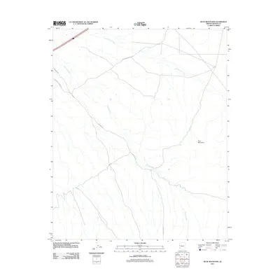
2011 Map of Buck Mountains
USGS Topo · Published 2011About this map
The Buck Mountains dominate this Mohave County landscape, where the arid terrain is defined by a network of ephemeral watercourses and early automotive routes. The map documents the persistent path of the National Old Trails Rd, a significant corridor from the early days of transcontinental travel, intersecting with Franconia Rd. The drainage patterns of the region are clearly delineated through the primary arteries of Buck Mountain Wash and Franconia Wash, which trace the low-lying areas between the slopes. This 2011 survey by the U.S. Geological Survey provides a detailed look at the infrastructure of this desert environment, including more recent additions like Rice Dr, showing how the modern road network continues to navigate the ancient natural contours of the wash systems.
Find a feature on this map
6 named features on this map. Tap any name to fly to it.
Don’t see what you’re looking for? This feature index may not catch every label — zoom into the map to look around manually.
Map Details
Editions of this 2011 Buck Mountains Map
This is the sole edition of this map. No revisions or reprints were ever made.
Other maps of this area

1903 · Needles
USGS Topo · 1:125,000

1904 · Needles Special
USGS Topo · 1:125,000

1927 · Yucca
USGS Topo · 1:62,500

1927 · Buck Mountains
USGS Topo · 1:62,500

1929 · Buck Mountains
USGS Topo · 1:62,500

1929 · Yucca
USGS Topo · 1:62,500

1943 · Topock
USGS Topo · 1:62,500

1950 · Topock
USGS Topo · 1:62,500

1951 · Topock
USGS Topo · 1:62,500

1954 · Needles
USGS Topo · 1:250,000