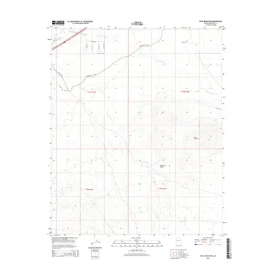
2014 Map of Buck Mountains
USGS Topo · Published 2014About this map
The Buck Mountains dominate this arid landscape in Mohave County, where the high desert terrain transitions into the wide expanse of Dutch Flat. This area is characterized by significant drainage systems, notably Buck Mountain Wash and Franconia Wash, which cut through the Mojave Desert floor. Of historical importance to travelers, the National Old Trails Rd traverses the northern section of the map, tracing a route that was once a primary transcontinental highway across the American West. The grid of local roads near the northern boundary, including W Haven Dr and S Diego Rd, indicates localized development and land use amidst the larger desert washes. Utility infrastructure is also present via Pipeline Rd, highlighting the functional role this desert corridor plays in the region's connectivity.
Find a feature on this map
19 named features on this map. Tap any name to fly to it.
Don’t see what you’re looking for? This feature index may not catch every label — zoom into the map to look around manually.
Map Details
Editions of this 2014 Buck Mountains Map
This is the sole edition of this map. No revisions or reprints were ever made.
Other maps of this area

1903 · Needles
USGS Topo · 1:125,000

1904 · Needles Special
USGS Topo · 1:125,000

1927 · Yucca
USGS Topo · 1:62,500

1927 · Buck Mountains
USGS Topo · 1:62,500

1929 · Buck Mountains
USGS Topo · 1:62,500

1929 · Yucca
USGS Topo · 1:62,500

1943 · Topock
USGS Topo · 1:62,500

1950 · Topock
USGS Topo · 1:62,500

1951 · Topock
USGS Topo · 1:62,500

1954 · Needles
USGS Topo · 1:250,000