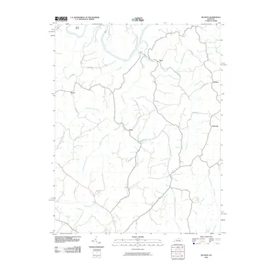
2010 Map of Buckeye
USGS Topo · Published 2010About this map
The Kentucky River carves a dramatic path through this Garrard County landscape, punctuated by the sharp bend at Devils Elbow. This 2010 survey highlights a rural network of small settlements and family-named roads that define the central Kentucky interior. Small communities like Buckeye, Judson, and Teatersville are connected by a web of thoroughfares such as Sugar Creek Pike and Jack Turner Rd, showing a transition of land use along the tributaries of Sugar Creek. The terrain is deeply etched by numerous waterways, including the East Fork Sugar Creek, West Fork Sugar Creek, and Middle Fork Sugar Creek, which converge to feed the primary river system. Local genealogists and historians can trace lineage and land ownership through labels like Tommy Murphy Rd and Dan Noel Rd, which anchor these rural locales to specific families and historical holdings.
Find a feature on this map
36 named features on this map. Tap any name to fly to it.
Don’t see what you’re looking for? This feature index may not catch every label — zoom into the map to look around manually.
Map Details
Editions of this 2010 Buckeye Map
This is the sole edition of this map. No revisions or reprints were ever made.
Other maps of this area

1892 · Richmond
USGS Topo · 1:125,000

1897 · Richmond
USGS Topo · 1:125,000

1905 · Harrodsburg
USGS Topo · 1:125,000

1950 · Bryantsville
USGS Topo · 1:24,000

1952 · Valley View
USGS Topo · 1:24,000

1952 · Little Hickman
USGS Topo · 1:24,000

1952 · Buckeye
USGS Topo · 1:24,000

1952 · Paint Lick
USGS Topo · 1:24,000

1952 · Lancaster
USGS Topo · 1:24,000

1952 · Bryantsville
USGS Topo · 1:24,000