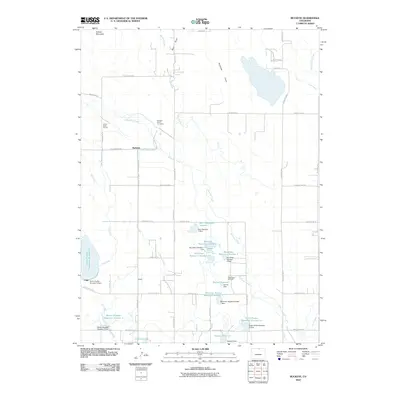
2010 Map of Buckeye
USGS Topo · Published 2010About this map
Buckeye Ranch Cemetery and the small settlement of Buckeye anchor this portion of northern Colorado, where the high plains meet the foothills of Gilman Mountain. The landscape is defined by an extensive water management system designed for high-altitude agriculture, featuring a dense network of irrigation laterals such as the Buckeye Lateral and Park Creek Lateral. These channels feed numerous storage sites including Boxelder Reservoir Number 1, Mountain Supply Reservoir Number 7, and the North Poudre Reservoir Number 15.
Find a feature on this map
61 named features on this map. Tap any name to fly to it.
Don’t see what you’re looking for? This feature index may not catch every label — zoom into the map to look around manually.
Map Details
Editions of this 2010 Buckeye Map
This is the sole edition of this map. No revisions or reprints were ever made.
Other maps of this area

1906 · Fort Collins
USGS Topo · 1:62,500

1907 · Livermore
USGS Topo · 1:125,000

1908 · Fort Collins
USGS Topo · 1:62,500

1908 · Eaton
USGS Topo · 1:125,000

1909 · Livermore
USGS Topo · 1:125,000

1910 · Eaton
USGS Topo · 1:125,000

1954 · Greeley
USGS Topo · 1:250,000

1957 · Greeley
USGS Topo · 1:250,000

1958 · Greeley
USGS Topo · 1:250,000

1960 · Livermore
USGS Topo · 1:24,000