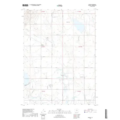
2019 Map of Buckeye
USGS Topo · Published 2019About this map
Buckeye sits at the center of this high-plains landscape, where the agricultural economy of Larimer County is defined by an intricate network of water management. The terrain transitions from the elevations of Gilman Mtn in the northwest down toward the expansive Rawhide Flats. This dependency on irrigation is evidenced by the numerous man-made features such as the Buckeye Lateral and Park Cr Lateral, which feed a series of numbered basins including North Poudre Reservoir Number 15 and Box Elder Reservoir Number 2. For genealogists, the Buckeye Ranch Cem provides a specific point of historical reference near the main settlement. The landscape is also characterized by seasonal drainage through Rawhide Cr and Dry Cr, illustrating the careful balance of water capture and distribution required for ranching and farming in this part of Colorado.
Find a feature on this map
65 named features on this map. Tap any name to fly to it.
Don’t see what you’re looking for? This feature index may not catch every label — zoom into the map to look around manually.
Map Details
Editions of this 2019 Buckeye Map
This is the sole edition of this map. No revisions or reprints were ever made.
Other maps of this area

1906 · Fort Collins
USGS Topo · 1:62,500

1907 · Livermore
USGS Topo · 1:125,000

1908 · Fort Collins
USGS Topo · 1:62,500

1908 · Eaton
USGS Topo · 1:125,000

1909 · Livermore
USGS Topo · 1:125,000

1910 · Eaton
USGS Topo · 1:125,000

1954 · Greeley
USGS Topo · 1:250,000

1957 · Greeley
USGS Topo · 1:250,000

1958 · Greeley
USGS Topo · 1:250,000

1960 · Livermore
USGS Topo · 1:24,000