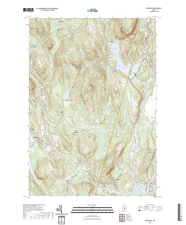
2024 Map of Buckfield
USGS Topo · Published 2024About this map
The Nezinscot River and its West Branch carve through this landscape at the intersection of Oxford and Androscoggin counties. Centered on the village of Buckfield, the topography is defined by significant rises such as Bear Mtn and Hayford Hill, which overlook a network of smaller water bodies including Little Bear Pond and Crystal Pond. The mapping reveals a rural infrastructure deeply rooted in family history, evidenced by numerous burial sites like the Harlow Family Cem and Chase Family Cem. Small hamlets such as East Buckfield and Chase Mills mark the crossroads of old transit routes, including the Railroad Bed Rd, while the presence of Oxford Spring hints at the area's natural hydrology. This 2024 survey documents the enduring settlement patterns of central Maine, where isolated hills like Deacon Pinnacle stand above complex wetlands like Jersey Bog.
Find a feature on this map
103 named features on this map. Tap any name to fly to it.
Don’t see what you’re looking for? This feature index may not catch every label — zoom into the map to look around manually.
Map Details
Editions of this 2024 Buckfield Map
This is the sole edition of this map. No revisions or reprints were ever made.
Other maps of this area

1908 · Poland
USGS Topo · 1:62,500

1908 · Lewiston
USGS Topo · 1:62,500

1910 · Livermore
USGS Topo · 1:62,500

1911 · Buckfield
USGS Topo · 1:62,500

1912 · Livermore
USGS Topo · 1:62,500

1913 · Buckfield
USGS Topo · 1:62,500

1940 · Poland
USGS Topo · 1:62,500

1941 · Livermore
USGS Topo · 1:62,500

1942 · Lewiston
USGS Topo · 1:62,500

1942 · Buckfield
USGS Topo · 1:62,500