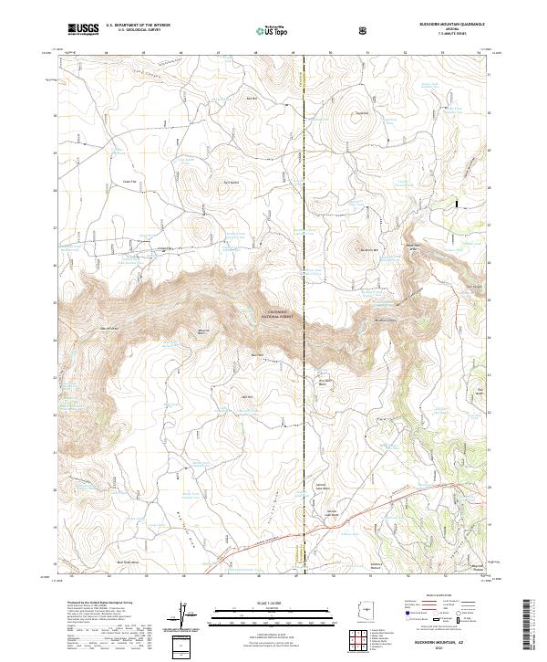
2021 Map of Buckhorn Mountain
USGS Topo · Published 2021About this map
The Coconino National Forest defines this high-altitude landscape where the Mogollon Plateau meets deep drainage systems. The map prominently features the historic General Crook Trl, a vital military and supply route through the Arizona territory. This corridor transitions from the flat expanses of Mud Tanks Mesa and Indian Flat into the dramatic descent of West Clear Creek Canyon. The terrain is marked by numerous natural and man-made water catchments, such as Utopia Tank and Salmon Lake, which were essential for supporting livestock and travelers in this arid environment. Significant landmarks like Buckhorn Mtn and Twin Buttes provide vertical relief against the canyon draws of Tule Canyon and Meadow Canyon, illustrating the complex topography used by early ranchers and foresters.
Find a feature on this map
88 named features on this map. Tap any name to fly to it.
Don’t see what you’re looking for? This feature index may not catch every label — zoom into the map to look around manually.
Map Details
Editions of this 2021 Buckhorn Mountain Map
This is the sole edition of this map. No revisions or reprints were ever made.
Other maps of this area

1887 · Verde
USGS Topo · 1:250,000

1892 · Verde
USGS Topo · 1:250,000

1923 · Camp Verde
USGS Topo · 1:125,000

1929 · Turret Peak
USGS Topo · 1:125,000

1932 · Camp Verde
USGS Topo · 1:125,000

1933 · Turret Peak
USGS Topo · 1:125,000

1934 · Pine
USGS Topo · 1:62,500

1936 · Camp Verde
USGS Topo · 1:125,000

1940 · Pine
USGS Topo · 1:62,500

1952 · Pine
USGS Topo · 1:62,500