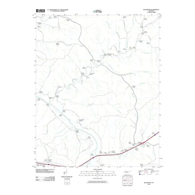
2010 Map of Bucksnort
USGS Topo · Published 2010About this map
Duck River meanders through the heart of this Tennessee landscape, joined by numerous tributaries that have carved out an intricate network of hollows. The terrain is defined by these deep recesses, such as Bissell Hollow, Kline Hollow, and Mossy Shoals Hollow, which often bear family names of early residents. Rural life is anchored by a significant number of family burial grounds scattered across the high ground and creek banks, including Young Cemetery, Larkin Cemetery, and Sanders Cemetery.
Find a feature on this map
87 named features on this map. Tap any name to fly to it.
Don’t see what you’re looking for? This feature index may not catch every label — zoom into the map to look around manually.
Map Details
Editions of this 2010 Bucksnort Map
This is the sole edition of this map. No revisions or reprints were ever made.
Other maps of this area

1936 · Gorman
USGS Topo · 1:24,000

1936 · Hurricane Mills
USGS Topo · 1:24,000

1936 · Coble
USGS Topo · 1:24,000

1936 · Whitfield
USGS Topo · 1:24,000

1936 · Bucksnort
USGS Topo · 1:24,000

1936 · Spot
USGS Topo · 1:24,000

1936 · Lobelville
USGS Topo · 1:24,000

1936 · Waverly
USGS Topo · 1:24,000

1936 · Tennessee City
USGS Topo · 1:24,000
1950 · Hurricane Mills
USGS Topo · 1:24,000