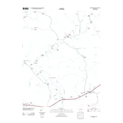
2013 Map of Bucksnort
USGS Topo · Published 2013About this map
Duck River hydrology and the winding paths of rural hollows define this portion of Tennessee. The landscape is marked by small settlements like Bucksnort and Bold Spring, where early transportation and local industry shaped the community. The presence of Furnace and the Grandfathers Building suggests a history of localized commerce and gathering, while religious life is anchored at Wills Chapel.
Find a feature on this map
92 named features on this map. Tap any name to fly to it.
Don’t see what you’re looking for? This feature index may not catch every label — zoom into the map to look around manually.
Map Details
Editions of this 2013 Bucksnort Map
This is the sole edition of this map. No revisions or reprints were ever made.
Other maps of this area

1936 · Gorman
USGS Topo · 1:24,000

1936 · Hurricane Mills
USGS Topo · 1:24,000

1936 · Coble
USGS Topo · 1:24,000

1936 · Whitfield
USGS Topo · 1:24,000

1936 · Bucksnort
USGS Topo · 1:24,000

1936 · Spot
USGS Topo · 1:24,000

1936 · Lobelville
USGS Topo · 1:24,000

1936 · Waverly
USGS Topo · 1:24,000

1936 · Tennessee City
USGS Topo · 1:24,000
1950 · Hurricane Mills
USGS Topo · 1:24,000