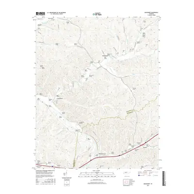
2016 Map of Bucksnort
USGS Topo · Published 2016About this map
The Duck River meanders through the southern portion of this region, creating a complex geography of ridges and deep hollows along the border of Humphreys and Hickman counties. This 2016 survey shows the rural character of communities like Bold Spring and Taylortown, where the landscape is defined by its watercourses such as Tumbling Cr and Hurricane Creek. The area’s history is preserved in numerous family and community burial grounds, including the Schoolhouse Cem and Pruett Cem, which are tucked away in the various hollows that drain toward the river. Near the southern edge, the settlement of Bucksnort sits along Sugar Cr, while the landmark Standing Rock and the Grandfathers Building provide distinctive points of interest within the rugged Tennessee interior.
Find a feature on this map
103 named features on this map. Tap any name to fly to it.
Don’t see what you’re looking for? This feature index may not catch every label — zoom into the map to look around manually.
Map Details
Editions of this 2016 Bucksnort Map
This is the sole edition of this map. No revisions or reprints were ever made.
Other maps of this area

1936 · Gorman
USGS Topo · 1:24,000

1936 · Hurricane Mills
USGS Topo · 1:24,000

1936 · Coble
USGS Topo · 1:24,000

1936 · Whitfield
USGS Topo · 1:24,000

1936 · Bucksnort
USGS Topo · 1:24,000

1936 · Spot
USGS Topo · 1:24,000

1936 · Lobelville
USGS Topo · 1:24,000

1936 · Waverly
USGS Topo · 1:24,000

1936 · Tennessee City
USGS Topo · 1:24,000
1950 · Hurricane Mills
USGS Topo · 1:24,000