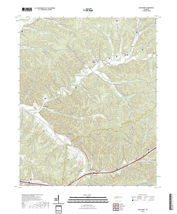
2022 Map of Bucksnort
USGS Topo · Published 2022About this map
The Duck River meanders through this portion of Humphreys and Hickman counties, carving a complex network of hollows and ridges that define the local geography. Near the river, landmarks like Standing Rock and Bickerstaff Eddy suggest a landscape shaped by both water and tradition, while the presence of the Grandfathers Building points to specific local history. The settlement of Bucksnort sits at a critical junction near the southern edge, supported by the waters of Sugar Creek and the nearby community of Furnace.
Find a feature on this map
106 named features on this map. Tap any name to fly to it.
Don’t see what you’re looking for? This feature index may not catch every label — zoom into the map to look around manually.
Map Details
Editions of this 2022 Bucksnort Map
This is the sole edition of this map. No revisions or reprints were ever made.
Other maps of this area

1936 · Gorman
USGS Topo · 1:24,000

1936 · Hurricane Mills
USGS Topo · 1:24,000

1936 · Coble
USGS Topo · 1:24,000

1936 · Whitfield
USGS Topo · 1:24,000

1936 · Bucksnort
USGS Topo · 1:24,000

1936 · Spot
USGS Topo · 1:24,000

1936 · Lobelville
USGS Topo · 1:24,000

1936 · Waverly
USGS Topo · 1:24,000

1936 · Tennessee City
USGS Topo · 1:24,000
1950 · Hurricane Mills
USGS Topo · 1:24,000