
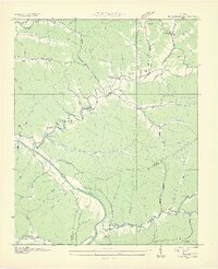
1936 Map of Bucksnort
USGS Topo · Published 1936About this map
The Duck River winds through a dense network of hollows along the border of Humphreys and Hickman Counties in this 1936 Tennessee Valley Authority and USGS survey. This era reveals a landscape defined by small, isolated communities like Bucksnort and Bold Spring, where life centered around local landmarks such as Old Furnace Sch and Harmony Sch Ch. The survey detail highlights the intricate drainage systems of the western Highland Rim, from the sprawling Egypt Hollow to the many branches feeding into Sugar Creek and Tumbling Creek. Genealogists will find significant value in the documentation of family-named burial grounds, including Pruett Cem, Larkin Cem, and McClannahan Cem, alongside vanished school sites like Wills Chapel Sch. The transition from rural trails to established roads reflects the early infrastructure development in this corner of Tennessee.
Find a feature on this map
60 named features on this map. Tap any name to fly to it.
Don’t see what you’re looking for? This feature index may not catch every label — zoom into the map to look around manually.
Map Details
Editions of this 1936 Bucksnort Map
2 editions found
Other maps of this area

1936 · Gorman
USGS Topo · 1:24,000

1936 · Hurricane Mills
USGS Topo · 1:24,000

1936 · Coble
USGS Topo · 1:24,000

1936 · Whitfield
USGS Topo · 1:24,000

1936 · Spot
USGS Topo · 1:24,000

1936 · Lobelville
USGS Topo · 1:24,000

1936 · Waverly
USGS Topo · 1:24,000

1936 · Tennessee City
USGS Topo · 1:24,000
1950 · Hurricane Mills
USGS Topo · 1:24,000
1950 · Waverly
USGS Topo · 1:24,000