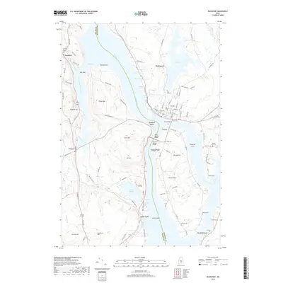
2018 Map of Bucksport
USGS Topo · Published 2018About this map
The Penobscot River and its complex network of inlets and islands define this coastal Maine landscape, where the town of Bucksport sits across from Verona Island. The narrow crossing at Prospect Ferry is bridged by the Penobscot Narrows Bridge, connecting the mainland communities of Prospect and Verona. The terrain is characterized by significant elevations including Heagan Mtn and Mt Tuck, which rise above the surrounding tidal flats and marshes of Marsh Bay. Numerous small graveyards are scattered across the quadrangle, such as Silver Lake Cem and Whitman Cem, providing a detailed record of the area's local lineage and settlement patterns. To the south, the village of Sandy Point sits near the confluence of the river and the Eastern Channel, illustrating the enduring importance of these waterways for navigation and local commerce in the modern era.
Find a feature on this map
108 named features on this map. Tap any name to fly to it.
Don’t see what you’re looking for? This feature index may not catch every label — zoom into the map to look around manually.
Map Details
Editions of this 2018 Bucksport Map
This is the sole edition of this map. No revisions or reprints were ever made.
Other maps of this area

1900 · Orland
USGS Topo · 1:62,500

1900 · Bucksport
USGS Topo · 1:62,500

1902 · Bucksport
USGS Topo · 1:62,500

1902 · Castine
USGS Topo · 1:62,500

1904 · Castine
USGS Topo · 1:62,500

1904 · Bluehill
USGS Topo · 1:62,500

1905 · Penobscot Bay
USGS Topo · 1:125,000

1941 · Castine
USGS Topo · 1:62,500

1942 · Orland
USGS Topo · 1:62,500

1942 · Bucksport
USGS Topo · 1:62,500