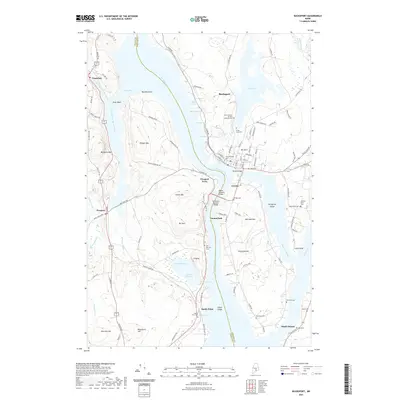
2021 Map of Bucksport
USGS Topo · Published 2021About this map
The Penobscot River serves as the central artery of this coastal Maine landscape, dividing Waldo and Hancock counties while connecting the historic waterfront of Bucksport to the surrounding hills. This area is defined by its deep water access and strategic geography, where the river narrows between Prospect Ferry and the northern tip of Verona Island. The town of Bucksport is densely mapped with streets like Main St and Central St, alongside numerous burial grounds including Oak Hill Cem and Saint Vincent De Paul Catholic Cem.
Find a feature on this map
120 named features on this map. Tap any name to fly to it.
Don’t see what you’re looking for? This feature index may not catch every label — zoom into the map to look around manually.
Map Details
Editions of this 2021 Bucksport Map
This is the sole edition of this map. No revisions or reprints were ever made.
Other maps of this area

1900 · Orland
USGS Topo · 1:62,500

1900 · Bucksport
USGS Topo · 1:62,500

1902 · Bucksport
USGS Topo · 1:62,500

1902 · Castine
USGS Topo · 1:62,500

1904 · Castine
USGS Topo · 1:62,500

1904 · Bluehill
USGS Topo · 1:62,500

1905 · Penobscot Bay
USGS Topo · 1:125,000

1941 · Castine
USGS Topo · 1:62,500

1942 · Orland
USGS Topo · 1:62,500

1942 · Bucksport
USGS Topo · 1:62,500