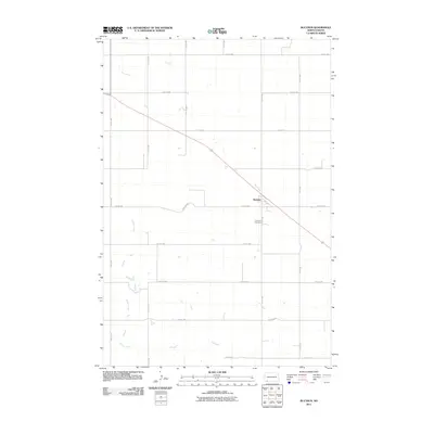
2011 Map of Bucyrus
USGS Topo · Published 2011About this map
Bucyrus sits at the heart of this prairie landscape, serving as a primary settlement node in Adams County during the early 21st century. The map illustrates a rigid grid of rural roads, including 9th Ave NW and 1st Ave W, which structure the agricultural layout of the region. Local hydrology is defined by the meandering paths of Flat Creek and Willow Creek, which break the geometric precision of the section lines. Just south of the main townsite, the Bucyrus Cemetery serves as a significant landmark for those tracing local family histories and lineage in this part of North Dakota. The transport network is anchored by a series of numbered streets and avenues, such as 12th St NW and 5th Ave NW, which facilitate movement across the wide open reaches of the plains.
Find a feature on this map
18 named features on this map. Tap any name to fly to it.
Don’t see what you’re looking for? This feature index may not catch every label — zoom into the map to look around manually.
Map Details
Editions of this 2011 Bucyrus Map
This is the sole edition of this map. No revisions or reprints were ever made.
Other maps of this area

1953 · Dickinson
USGS Topo · 1:250,000

1954 · Lemmon
USGS Topo · 1:250,000

1957 · Dickinson
USGS Topo · 1:250,000

1957 · Lemmon
USGS Topo · 1:250,000

1969 · Reeder
USGS Topo · 1:24,000

1974 · Hettinger North
USGS Topo · 1:24,000

1974 · Hettinger South
USGS Topo · 1:24,000

1974 · Cow Butte
USGS Topo · 1:24,000

1974 · Cow Butte NE
USGS Topo · 1:24,000

1980 · Mott
USGS Topo · 1:100,000