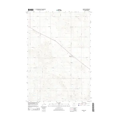
2014 Map of Bucyrus
USGS Topo · Published 2014About this map
The small settlement of Bucyrus serves as the focal point of this southwestern North Dakota landscape, situated along a prominent transportation corridor. The town's layout is defined by the intersection of Railway St and Bucyrus Rd, reflecting its reliance on rail and road networks. To the southeast, the Bucyrus Cem provides a local genealogical record for the community. The surrounding terrain is characterized by the drainages of Flat Cr in the north and Willow Cr in the south, which weave through a regular grid of section roads like 9th Ave NW and 12th St NW. This 2014 survey documents the enduring agricultural structure of Adams County, where the vast prairie is partitioned by a meticulous network of numbered avenues and streets that facilitate the region's ranching and farming operations.
Find a feature on this map
22 named features on this map. Tap any name to fly to it.
Don’t see what you’re looking for? This feature index may not catch every label — zoom into the map to look around manually.
Map Details
Editions of this 2014 Bucyrus Map
This is the sole edition of this map. No revisions or reprints were ever made.
Other maps of this area

1953 · Dickinson
USGS Topo · 1:250,000

1954 · Lemmon
USGS Topo · 1:250,000

1957 · Dickinson
USGS Topo · 1:250,000

1957 · Lemmon
USGS Topo · 1:250,000

1969 · Reeder
USGS Topo · 1:24,000

1974 · Hettinger North
USGS Topo · 1:24,000

1974 · Hettinger South
USGS Topo · 1:24,000

1974 · Cow Butte
USGS Topo · 1:24,000

1974 · Cow Butte NE
USGS Topo · 1:24,000

1980 · Mott
USGS Topo · 1:100,000