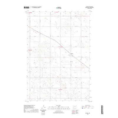
2020 Map of Bucyrus
USGS Topo · Published 2020About this map
The town of Bucyrus serves as the central hub of this Adams County landscape, situated along the diagonal path of Railway St. This 2020 survey illustrates a region defined by its rigid section-line road network, including thoroughfares like Bucyrus Rd and 1st Ave W, which contrast with the natural, winding drainage patterns of Flat Cr. Genealogists will find the Bucyrus Cem located just south of the main settlement, a primary point of interest for local family history research. The surrounding terrain is primarily agricultural, punctuated by a series of trails such as the 9th Ave Nw Trl, indicating the persistent use of more informal pathways alongside the modern grid. The map provides a clear record of the rural infrastructure in southwestern North Dakota, preserving the relationship between the town site and the sprawling township boundaries of the early 21st century.
Find a feature on this map
27 named features on this map. Tap any name to fly to it.
Don’t see what you’re looking for? This feature index may not catch every label — zoom into the map to look around manually.
Map Details
Editions of this 2020 Bucyrus Map
This is the sole edition of this map. No revisions or reprints were ever made.
Other maps of this area

1953 · Dickinson
USGS Topo · 1:250,000

1954 · Lemmon
USGS Topo · 1:250,000

1957 · Dickinson
USGS Topo · 1:250,000

1957 · Lemmon
USGS Topo · 1:250,000

1969 · Reeder
USGS Topo · 1:24,000

1974 · Hettinger North
USGS Topo · 1:24,000

1974 · Hettinger South
USGS Topo · 1:24,000

1974 · Cow Butte
USGS Topo · 1:24,000

1974 · Cow Butte NE
USGS Topo · 1:24,000

1980 · Mott
USGS Topo · 1:100,000