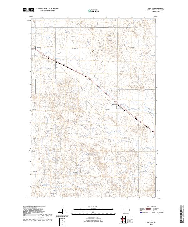
2024 Map of Bucyrus
USGS Topo · Published 2024About this map
Bucyrus sits at the heart of this Adams County landscape, positioned along the historical alignment of Railway St and the southern bank of Flat Creek. The town serves as a focal point for the surrounding agricultural grid, where the intersection of Bucyrus Rd and various section lines organizes the prairie terrain. To the south, the Bucyrus Cem provides a point of significant interest for genealogists and local historians, anchoring the community's heritage in the open plains. The drainage patterns of the region are defined by the winding courses of Flat Creek in the north and Willow Creek in the southwest, illustrating the subtle hydrology that has shaped rural settlement and land use in this part of North Dakota. This survey reflects the enduring structure of the Public Land Survey System, with township boundaries like t130n r97w clearly marking the transition between the rolling hills and creek bottoms.
Find a feature on this map
31 named features on this map. Tap any name to fly to it.
Don’t see what you’re looking for? This feature index may not catch every label — zoom into the map to look around manually.
Map Details
Editions of this 2024 Bucyrus Map
This is the sole edition of this map. No revisions or reprints were ever made.
Other maps of this area

1953 · Dickinson
USGS Topo · 1:250,000

1954 · Lemmon
USGS Topo · 1:250,000

1957 · Dickinson
USGS Topo · 1:250,000

1957 · Lemmon
USGS Topo · 1:250,000

1969 · Reeder
USGS Topo · 1:24,000

1974 · Hettinger North
USGS Topo · 1:24,000

1974 · Hettinger South
USGS Topo · 1:24,000

1974 · Cow Butte
USGS Topo · 1:24,000

1974 · Cow Butte NE
USGS Topo · 1:24,000

1980 · Mott
USGS Topo · 1:100,000