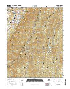
2016 Map of Buena Vista
USGS Topo · Published 2016About this map
Buena Vista serves as the focal point of this survey, where the Maury River corridor transitions into the steep ridges of the George Washington National Forest. The map illustrates the town's grid and its relationship with the Southern Virginia Univ campus and Green Hill Cem on the western edge. To the east, the landscape is defined by the high elevations of the Blue Ridge, where the Blue Ridge Pkwy and the Appalachian National Scenic Trail follow the crest through points like Bluff Mtn and Robinson Gap Roundtop. Small, remote settlements such as Beverlytown and Oronoco are tucked into the hollows and mountain gaps. The hydrological network is dominated by the Pedlar River, which feeds into the Lynchburg Reservoir, highlighting the area's role in the regional water supply system. Engineers and hikers alike can trace the path of the Bluff Mountain Tunnel as it cuts beneath the ridgeline.
Find a feature on this map
90 named features on this map. Tap any name to fly to it.
Don’t see what you’re looking for? This feature index may not catch every label — zoom into the map to look around manually.
Map Details
Editions of this 2016 Buena Vista Map
This is the sole edition of this map. No revisions or reprints were ever made.
Other maps of this area

1894 · Lexington
USGS Topo · 1:125,000

1932 · Lexington
USGS Topo · 1:48,000

1935 · Buena Vista
USGS Topo · 1:48,000

1935 · Amherst
USGS Topo · 1:48,000

1936 · Vesuvius
USGS Topo · 1:48,000

1937 · Lexington
USGS Topo · 1:62,500

1939 · Amherst
USGS Topo · 1:62,500

1939 · Buena Vista
USGS Topo · 1:62,500

1940 · Buena Vista
USGS Topo · 1:62,500

1941 · Vesuvius
USGS Topo · 1:62,500