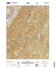
2019 Map of Buena Vista
USGS Topo · Published 2019About this map
Buena Vista sits at the western base of the Blue Ridge, where the Maury River transitions from the mountains into the valley. This 2019 survey captures the city's complex interface with the George Washington National Forest, showing the grid of the town anchored by Southern Virginia University and the Buena Vista City Courthouse. The eastern half of the map is defined by the high ridges and deep hollows of the Blue Ridge, crossed by the winding Blue Ridge Parkway and the Appalachian National Scenic Trail.
Find a feature on this map
90 named features on this map. Tap any name to fly to it.
Don’t see what you’re looking for? This feature index may not catch every label — zoom into the map to look around manually.
Map Details
Editions of this 2019 Buena Vista Map
This is the sole edition of this map. No revisions or reprints were ever made.
Other maps of this area

1894 · Lexington
USGS Topo · 1:125,000

1932 · Lexington
USGS Topo · 1:48,000

1935 · Buena Vista
USGS Topo · 1:48,000

1935 · Amherst
USGS Topo · 1:48,000

1936 · Vesuvius
USGS Topo · 1:48,000

1937 · Lexington
USGS Topo · 1:62,500

1939 · Amherst
USGS Topo · 1:62,500

1939 · Buena Vista
USGS Topo · 1:62,500

1940 · Buena Vista
USGS Topo · 1:62,500

1941 · Vesuvius
USGS Topo · 1:62,500