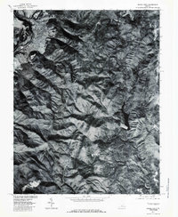
1977 Map of Buena Vista
USGS Topo · Published 1983About this map
Buena Vista sits at the edge of the mountains where the James River cuts through the gap, serving as a primary point of settlement in this 1977 orthophotograph. The imagery captures the winding path of the Blue Ridge Parkway as it traverses high elevations near Bluff Mountain and Robinson Gap. The landscape transitions from the developed riverfront to the dense forest of the Blue Ridge, where small communities like Oronoco and Beverlytown are situated in the high country. In the eastern portion of the map, the Lynchburg Reservoir and the headwaters of the Pedlar River provide a critical water source for the region. This aerial perspective, prepared from 1977 photography, highlights the dramatic vertical relief of the territory and the isolation of the mountain hamlets relative to the more industrial valley floor.
Find a feature on this map
10 named features on this map. Tap any name to fly to it.
Don’t see what you’re looking for? This feature index may not catch every label — zoom into the map to look around manually.
Map Details
Editions of this 1977 Buena Vista Map
This is the sole edition of this map. No revisions or reprints were ever made.
Other maps of this area

1894 · Lexington
USGS Topo · 1:125,000

1932 · Lexington
USGS Topo · 1:48,000

1935 · Buena Vista
USGS Topo · 1:48,000

1935 · Amherst
USGS Topo · 1:48,000

1936 · Vesuvius
USGS Topo · 1:48,000

1937 · Lexington
USGS Topo · 1:62,500

1939 · Amherst
USGS Topo · 1:62,500

1939 · Buena Vista
USGS Topo · 1:62,500

1940 · Buena Vista
USGS Topo · 1:62,500

1941 · Vesuvius
USGS Topo · 1:62,500