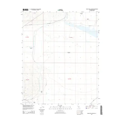
2015 Map of Buena Vista Lake Bed
USGS Topo · Published 2015About this map
The Buena Vista Lake Bed dominates this portion of the southern San Joaquin Valley, showing a landscape heavily modified by California's complex water management systems. The most prominent industrial feature is the Governor Edmund G Brown California Aqueduct, which cuts a distinct path south through the Buena Vista Valley. To the north and west, the terrain rises into the Elk Hills and Buena Vista Hills, while the flat basin floor is occupied by Lake Webb and Lake Evans. The presence of the Outlet Canal and various named roads such as Lake Station Rd and Golf Course Rd indicates a developed network supporting the surrounding energy and agricultural sectors. This 2015 survey provides a clear look at the intersection of natural drainage like Sandy Creek with the engineered infrastructure that has reshaped the Central Valley.
Find a feature on this map
25 named features on this map. Tap any name to fly to it.
Don’t see what you’re looking for? This feature index may not catch every label — zoom into the map to look around manually.
Map Details
Editions of this 2015 Buena Vista Lake Bed Map
This is the sole edition of this map. No revisions or reprints were ever made.
Other maps of this area

1910 · Buena Vista Lake
USGS Topo · 1:125,000

1912 · Buena Vista Lake
USGS Topo · 1:125,000

1929 · Stevens
USGS Topo · 1:31,680

1929 · Coles Levee
USGS Topo · 1:31,680

1929 · Mouth of Kern
USGS Topo · 1:31,680

1930 · Millux
USGS Topo · 1:31,680

1931 · Pentland Junction
USGS Topo · 1:31,680

1931 · Hayes Ranch
USGS Topo · 1:31,680

1932 · East Elk Hills
USGS Topo · 1:31,680

1932 · Mouth of Kern
USGS Topo · 1:31,680