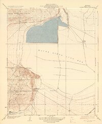
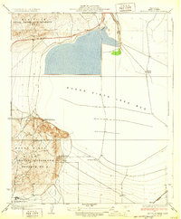
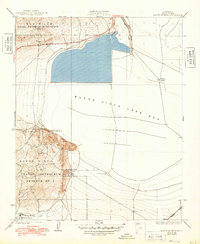
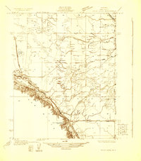
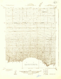
1932 Map of Mouth of Kern
USGS Topo · Published 1932About this map
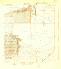
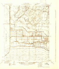
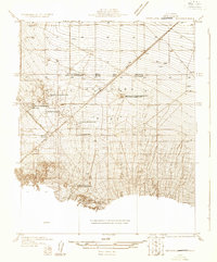
Industrial development and large-scale water management dominate the landscape at the southern end of the San Joaquin Valley. The vast Buena Vista Lake Bed is a central feature, managed by the Inlet Canal and Outlet Canal which regulate the flow of the Kern River. This area represents a critical intersection of California's early 20th-century energy and agricultural infrastructure. To the north and west, the Elk Hills and Buena Vista Hills host the Naval Petroleum Reserve No 1 and Naval Petroleum Reserve No 2, reflecting the strategic importance of this oil-rich territory. The presence of corporate facilities like the Honolulu Oil Co Water Pumping Sta and the Richfield Oil Co alongside the Old Gun Club illustrates the dual nature of the terrain as both a resource extraction hub and a site for recreational land use.
Find a feature on this map
17 named features on this map. Tap any name to fly to it.
Don’t see what you’re looking for? This feature index may not catch every label — zoom into the map to look around manually.
Map Details
Editions of this 1932 Mouth of Kern Map
3 editions found
Other maps of this area

1910 · Buena Vista Lake
USGS Topo · 1:125,000

1912 · Buena Vista Lake
USGS Topo · 1:125,000
1929 · Stevens
USGS Topo · 1:31,680
1929 · Coles Levee
USGS Topo · 1:31,680
1929 · Mouth of Kern
USGS Topo · 1:31,680
1930 · Millux
USGS Topo · 1:31,680
1931 · Pentland Junction
USGS Topo · 1:31,680
1931 · Hayes Ranch
USGS Topo · 1:31,680
1932 · East Elk Hills
USGS Topo · 1:31,680

1932 · Stevens
USGS Topo · 1:31,680