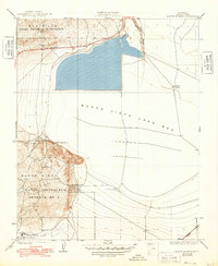
1932 Map of Mouth of Kern
USGS Topo · Published 1948About this map
Naval Petroleum Reserve No 1 and its southern counterpart, Naval Petroleum Reserve No 2, dominate the industrial landscape of Kern County in the late 1920s. This survey, conducted before the landscape was fully transformed by modern drainage, showcases the transition between natural hydrology and fossil fuel extraction. The massive expanse of the Buena Vista Lake Bed fills the central portion of the sheet, while the Inlet Canal and Outlet structures manage water flow adjacent to the Elk Hills.
Find a feature on this map
16 named features on this map. Tap any name to fly to it.
Don’t see what you’re looking for? This feature index may not catch every label — zoom into the map to look around manually.
Map Details
Editions of this 1932 Mouth of Kern Map
3 editions found
Other maps of this area

1910 · Buena Vista Lake
USGS Topo · 1:125,000

1912 · Buena Vista Lake
USGS Topo · 1:125,000

1929 · Stevens
USGS Topo · 1:31,680

1929 · Coles Levee
USGS Topo · 1:31,680

1929 · Mouth of Kern
USGS Topo · 1:31,680

1930 · Millux
USGS Topo · 1:31,680

1931 · Pentland Junction
USGS Topo · 1:31,680

1931 · Hayes Ranch
USGS Topo · 1:31,680

1932 · East Elk Hills
USGS Topo · 1:31,680

1932 · Mouth of Kern
USGS Topo · 1:31,680