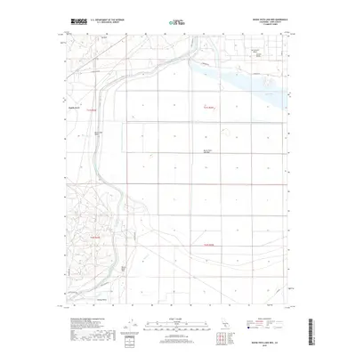
2018 Map of Buena Vista Lake Bed
USGS Topo · Published 2018About this map
Dustin Acres sits at the edge of a landscape defined by industrial-scale water management and significant topographical shifts. The central focus of the map is the expansive Buena Vista Lake Bed, situated between the Elk Hills to the north and the Buena Vista Hills to the south. This terrain illustrates the massive engineering of the Governor Edmund G Brown California Aqueduct, which winds through the western and southern sectors of the quadrangle. North of the dry lake bed, Lake Webb and the Outlet Canal represent modern recreational and drainage features within the broader San Joaquin Valley. The map also captures the transition from the flat agricultural expanses of the Central Valley to the more varied elevations of Midway Valley, providing a detailed look at Kern County's hydraulic and natural geography during the early 21st century.
Find a feature on this map
25 named features on this map. Tap any name to fly to it.
Don’t see what you’re looking for? This feature index may not catch every label — zoom into the map to look around manually.
Map Details
Editions of this 2018 Buena Vista Lake Bed Map
This is the sole edition of this map. No revisions or reprints were ever made.
Other maps of this area

1910 · Buena Vista Lake
USGS Topo · 1:125,000

1912 · Buena Vista Lake
USGS Topo · 1:125,000

1929 · Stevens
USGS Topo · 1:31,680

1929 · Coles Levee
USGS Topo · 1:31,680

1929 · Mouth of Kern
USGS Topo · 1:31,680

1930 · Millux
USGS Topo · 1:31,680

1931 · Pentland Junction
USGS Topo · 1:31,680

1931 · Hayes Ranch
USGS Topo · 1:31,680

1932 · East Elk Hills
USGS Topo · 1:31,680

1932 · Mouth of Kern
USGS Topo · 1:31,680