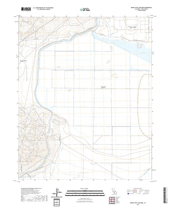
2021 Map of Buena Vista Lake Bed
USGS Topo · Published 2021About this map
Buena Vista Lake Bed dominates the central topography of this portion of the San Joaquin Valley, illustrating a landscape shaped by massive water infrastructure and industrial grid layouts. The Governor Edmund G Brown California Aqueduct cuts a definitive path through the northern and western sections, serving as a primary artery in this arid basin. To the north, Lake Webb and the Outlet Canal provide a contrast to the dry lake bed, while the settlement of Dustin Acres sits on the western margin near the transition to the Buena Vista Valley. The elevation increases significantly to the south and west in the Buena Vista Hills and Elk Hills, where the land is scored by drainages like Sandy Creek and Bitter Cr. The intersection of these hills with the Midway Valley highlights the complex geological transitions that define the southwestern corner of the quadrangle.
Find a feature on this map
26 named features on this map. Tap any name to fly to it.
Don’t see what you’re looking for? This feature index may not catch every label — zoom into the map to look around manually.
Map Details
Editions of this 2021 Buena Vista Lake Bed Map
This is the sole edition of this map. No revisions or reprints were ever made.
Other maps of this area

1910 · Buena Vista Lake
USGS Topo · 1:125,000

1912 · Buena Vista Lake
USGS Topo · 1:125,000

1929 · Stevens
USGS Topo · 1:31,680

1929 · Coles Levee
USGS Topo · 1:31,680

1929 · Mouth of Kern
USGS Topo · 1:31,680

1930 · Millux
USGS Topo · 1:31,680

1931 · Pentland Junction
USGS Topo · 1:31,680

1931 · Hayes Ranch
USGS Topo · 1:31,680

1932 · East Elk Hills
USGS Topo · 1:31,680

1932 · Mouth of Kern
USGS Topo · 1:31,680