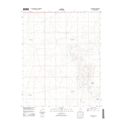
2013 Map of Bueyeros NE
USGS Topo · Published 2013About this map
Culbertson Ranch sits at the base of the prominent Cejita de los Comancheros escarpment, anchoring a landscape defined by livestock operations and cattle trails in Harding County. The terrain transitions from the high eastern mesa down through Bootleg Canyon and toward the drainage of Del Muerto Cr in the north. This 2013 survey illustrates the sparse, ranch-oriented infrastructure of the region, where a network of unpaved local routes like Culbertson Rd, Chappys Rd, and Lopez Rd connect remote holdings to NM-102. The mapping of these family-named roads and ranch sites provides a clear view of modern land use in a region where geography dictates the placement of settlements and transport corridors.
Find a feature on this map
13 named features on this map. Tap any name to fly to it.
Don’t see what you’re looking for? This feature index may not catch every label — zoom into the map to look around manually.
Map Details
Editions of this 2013 Bueyeros NE Map
This is the sole edition of this map. No revisions or reprints were ever made.
Other maps of this area

1954 · Tucumcari
USGS Topo · 1:250,000

1954 · Dalhart
USGS Topo · 1:250,000

1958 · Tucumcari
USGS Topo · 1:250,000

1958 · Dalhart
USGS Topo · 1:250,000

1962 · Dalhart
USGS Topo · 1:250,000

1966 · Pedernal Creek
USGS Topo · 1:24,000

1966 · Rosebud
USGS Topo · 1:24,000

1966 · Cottonwood Springs
USGS Topo · 1:24,000

1973 · Bueyeros NE
USGS Topo · 1:24,000

1973 · Circle Bar Ranch
USGS Topo · 1:24,000