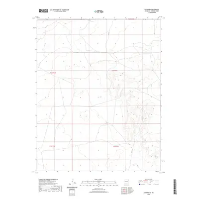
2020 Map of Bueyeros NE
USGS Topo · Published 2020About this map
The arid high-plains terrain of northeast New Mexico is defined by its drainages and remote ranch roads in this contemporary mapping of Harding County. Del Muerto Cr cuts through the northern portion of the landscape, while the southeastern corner is marked by the sharp topography of Bootleg Canyon. The map reveals a sparse infrastructure of local connectors and ranch access routes, including Chappys Rd, Culbertson Rd, and Lopez, which follow the contours of the land and established property lines. This area reflects the enduring open-range and ranching character of the region, where named landmarks often center on reliable water sources or significant geological breaks in the otherwise consistent plateau.
Find a feature on this map
11 named features on this map. Tap any name to fly to it.
Don’t see what you’re looking for? This feature index may not catch every label — zoom into the map to look around manually.
Map Details
Editions of this 2020 Bueyeros NE Map
This is the sole edition of this map. No revisions or reprints were ever made.
Other maps of this area

1954 · Tucumcari
USGS Topo · 1:250,000

1954 · Dalhart
USGS Topo · 1:250,000

1958 · Tucumcari
USGS Topo · 1:250,000

1958 · Dalhart
USGS Topo · 1:250,000

1962 · Dalhart
USGS Topo · 1:250,000

1966 · Pedernal Creek
USGS Topo · 1:24,000

1966 · Rosebud
USGS Topo · 1:24,000

1966 · Cottonwood Springs
USGS Topo · 1:24,000

1973 · Bueyeros NE
USGS Topo · 1:24,000

1973 · Circle Bar Ranch
USGS Topo · 1:24,000