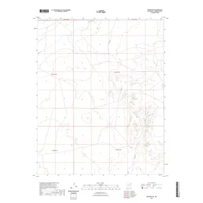
2023 Map of Bueyeros NE
USGS Topo · Published 2023About this map
Del Muerto Creek winds through the northern reaches of this Harding County landscape, carving a subtle drainage pattern through the high plains. The area is defined by a sparse network of ranch roads and township boundaries, reflecting the expansive and open nature of northeastern New Mexico. Local travel is marked by routes such as Chappys Rd and Culbertson Rd, which connect isolated points across the vast sections of t20n r32e and t19n r32e. A distinct track labeled Lopez and the intersection at Co Rd H suggest the enduring importance of established cattle ranching paths and land use patterns that have dictated movement in this corner of the state for generations.
Find a feature on this map
11 named features on this map. Tap any name to fly to it.
Don’t see what you’re looking for? This feature index may not catch every label — zoom into the map to look around manually.
Map Details
Editions of this 2023 Bueyeros NE Map
This is the sole edition of this map. No revisions or reprints were ever made.
Other maps of this area

1954 · Tucumcari
USGS Topo · 1:250,000

1954 · Dalhart
USGS Topo · 1:250,000

1958 · Tucumcari
USGS Topo · 1:250,000

1958 · Dalhart
USGS Topo · 1:250,000

1962 · Dalhart
USGS Topo · 1:250,000

1966 · Pedernal Creek
USGS Topo · 1:24,000

1966 · Rosebud
USGS Topo · 1:24,000

1966 · Cottonwood Springs
USGS Topo · 1:24,000

1973 · Bueyeros NE
USGS Topo · 1:24,000

1973 · Circle Bar Ranch
USGS Topo · 1:24,000