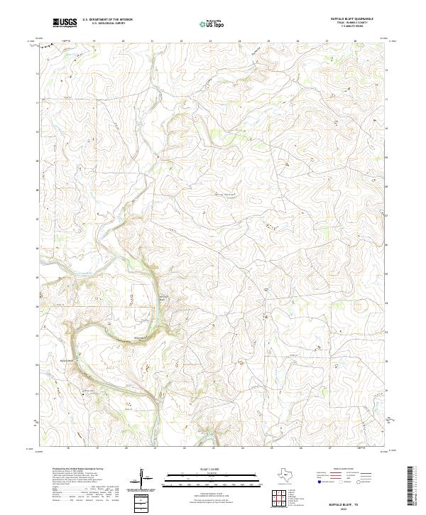
2022 Map of Buffalo Bluff
USGS Topo · Published 2022About this map
Colorado River frontage and significant relief define this section of Runnels County, where the waterway carves a path through high ground marked by Buffalo Bluff, Wilson Bluff, and Herrings Bluff. The landscape is dominated by a series of drainage systems, including Butternut Cr, Mustang Cr, and Rocky Br, which have shaped the surrounding terrain into notable features like Spring Hollow and Dry Hollow. For genealogists and local historians, the Hoffman Cem represents a critical landmark in this sparsely populated ranching and agricultural region. A network of county roads, such as Co RD 128 and Co RD 111, provides the primary access across the rolling hills and creek beds that feed into the main river channel.
Find a feature on this map
26 named features on this map. Tap any name to fly to it.
Don’t see what you’re looking for? This feature index may not catch every label — zoom into the map to look around manually.
Map Details
Editions of this 2022 Buffalo Bluff Map
This is the sole edition of this map. No revisions or reprints were ever made.
Other maps of this area

1892 · Ballinger
USGS Topo · 1:125,000

1921 · Hatchel
USGS Topo · 1:31,680

1921 · Spur Creek
USGS Topo · 1:31,680

1925 · Ballinger 3-d
USGS Topo · 1:48,000

1925 · Ballinger 4-c
USGS Topo · 1:48,000

1932 · Voss
USGS Topo · 1:62,500

1932 · Paint Rock
USGS Topo · 1:62,500

1954 · Brownwood
USGS Topo · 1:250,000
1967 · Hatchel
USGS Topo · 1:24,000

1967 · Talpa
USGS Topo · 1:24,000