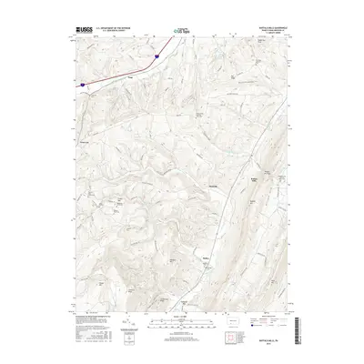
2016 Map of Buffalo Mills
USGS Topo · Published 2016About this map
Buffalo Mills sits at a critical gap in the ridge-and-valley landscape of Bedford County, where Little Wills Cr carves a passage through Buffalo Mtn. This terrain is defined by parallel ridges like Savage Mtn and Evitts Mtn, which have historically dictated the flow of travel and settlement along corridors such as the Glade Pike. The area is notably dense with small, localized burial sites, including the Wagerman Family Cem and the Shroyer Farm Cem, reflecting a long history of family-centered agricultural life.
Find a feature on this map
54 named features on this map. Tap any name to fly to it.
Don’t see what you’re looking for? This feature index may not catch every label — zoom into the map to look around manually.
Map Details
Editions of this 2016 Buffalo Mills Map
This is the sole edition of this map. No revisions or reprints were ever made.
Other maps of this area

1908 · Bedford
USGS Topo · 1:62,500

1910 · Bedford
USGS Topo · 1:62,500

1914 · Windber
USGS Topo · 1:62,500

1916 · Windber
USGS Topo · 1:62,500

1923 · Berlin
USGS Topo · 1:48,000

1927 · Hyndman
USGS Topo · 1:62,500

1929 · Berlin
USGS Topo · 1:62,500

1931 · Hyndman
USGS Topo · 1:62,500

1944 · Hyndman
USGS Topo · 1:62,500

1944 · Windber
USGS Topo · 1:62,500
Featured Places
- Londonderry Township, PA
- Harrison Township, PA
- Kegg, Juniata Township
- Buffalo Mills, Harrison Township
- Cumberland Valley Township, PA