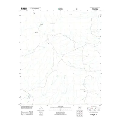
2011 Map of Buford Hill
USGS Topo · Published 2011About this map
Pinnacle Ridge and Cluff Peak define the high northern elevations of this landscape, where the terrain breaks into a complex network of dry washes and canyons. The W Klondyke Rd and Klondyke Bonita Rd provide the primary transit through the southern reaches, passing near Buhl Ranch along the banks of Araivaipa Creek. This 2011 survey reveals a landscape heavily dependent on isolated water sources for ranching and livestock, evidenced by the numerous named tanks such as Devil Tank, Buford Tank, and Register Tank scattered across the flats and foothills. Landmarks like Oak Butte and Cedar Springs Butte serve as navigation points in an area dominated by seasonal drainage systems, including Underwood Wash and Kennedy Falls Wash, which carve through the arid Graham County soil.
Find a feature on this map
38 named features on this map. Tap any name to fly to it.
Don’t see what you’re looking for? This feature index may not catch every label — zoom into the map to look around manually.
Map Details
Editions of this 2011 Buford Hill Map
This is the sole edition of this map. No revisions or reprints were ever made.
Other maps of this area

1938 · Galiuro Mts
USGS Topo · 1:48,000

1938 · Klondyke
USGS Topo · 1:48,000

1940 · Sierra Bonita Ranch
USGS Topo · 1:62,500

1942 · Sierra Bonita Ranch
USGS Topo · 1:62,500

1943 · Galiuro Mts
USGS Topo · 1:62,500

1943 · Klondyke
USGS Topo · 1:62,500

1943 · Sierra Bonita Ranch
USGS Topo · 1:62,500

1944 · Jackson Mtn.
USGS Topo · 1:62,500

1946 · Jackson Mtn.
USGS Topo · 1:62,500

1956 · Tucson
USGS Topo · 1:250,000