
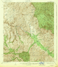
1943 Map of Klondyke
USGS Topo · Published 1943About this map
Aravaipa Creek carves a critical corridor through the high desert of the Coronado National Forest and Crook National Forest in this early 1940s survey. The landscape is defined by the sharp transition from the valley floor to the peaks of the Santa Teresa Mountains and Galiuro Mountains. While the settlement at Klondyke serves as a central hub, the map reveals a heavy reliance on mineral extraction, evidenced by a concentration of workings including the Grand Reef Mine and the Glory Hole Mine near Copper Creek. Regional infrastructure is represented by the Aravaipa Sch and the Aravaipa Ranger Station, suggesting a community anchored by both ranching and the forest service. Distinctive landmarks like The Chimney and Pinnacle Ridge rise above the drainage systems of Turkey Creek and Waterfall Canyon.
Find a feature on this map
73 named features on this map. Tap any name to fly to it.
Don’t see what you’re looking for? This feature index may not catch every label — zoom into the map to look around manually.
Map Details
Editions of this 1943 Klondyke Map
2 editions found
Other maps of this area

1911 · Winkelman
USGS Topo · 1:125,000

1913 · Winkelman
USGS Topo · 1:125,000

1915 · Christmas
USGS Topo · 1:62,500

1917 · Christmas
USGS Topo · 1:62,500

1938 · Galiuro Mts
USGS Topo · 1:48,000

1938 · Klondyke
USGS Topo · 1:48,000

1940 · Sierra Bonita Ranch
USGS Topo · 1:62,500

1942 · Sierra Bonita Ranch
USGS Topo · 1:62,500

1943 · Galiuro Mts
USGS Topo · 1:62,500

1943 · Sierra Bonita Ranch
USGS Topo · 1:62,500