
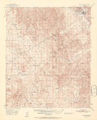
1911 Map of Winkelman
USGS Topo · Published 1957About this map
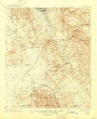
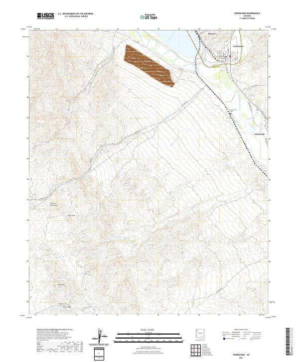
Winkelman and the confluence of the Gila River and San Pedro River serve as the focal point for this 1911 survey of the Pinal and Pima County borderlands. The landscape is defined by the extraction economy of the early twentieth century, with a concentration of industrial activity in the southern reaches. Notable operations include the Mammoth Mine, Ford Mine, and Mohawk Mine clustered near the settlement of Mammoth, while further south, the Southern Belle Mine and Bonito Mine sit within the Coronado National Forest. The region’s social structure is visible through its rural education network, featuring the Finch School, Aravaipa School, and Clark School. Evidence of the area's transition from open range to established ranching persists in the many named holdings, such as American Flag Ranch, Cottonwood Ranch, and Youngs Ranch, all connected by the historic Winkelman Road.
Find a feature on this map
84 named features on this map. Tap any name to fly to it.
Don’t see what you’re looking for? This feature index may not catch every label — zoom into the map to look around manually.
Map Details
Editions of this 1911 Winkelman Map
This is the sole edition of this map. No revisions or reprints were ever made.
Historical Maps of Saddlebrooke Through Time
10 maps found
1911 Winkelman
Pinal County, AZ
1913 Winkelman
Pinal County, AZ
1949 Winkelman
Pinal County, AZ
1949 Winkelman
Pinal County, AZ
1950 Winkelman
Pinal County, AZ
1951 Winkelman
Pinal County, AZ
2011 Winkelman
Pinal County, AZ
2014 Winkelman
Pinal County, AZ
2018 Winkelman
Pinal County, AZ
2021 Winkelman
Pinal County, AZ