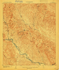
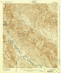
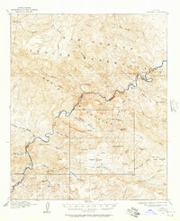
1910 Map of Ray
USGS Topo · Published 1910About this map
The copper-rich landscape of the Mescal Mountains dominates this early twentieth-century topographic study, centered on the burgeoning mining activity of central Arizona. The Ray Mine sits at the head of Mineral Cr, supported by a network of smaller operations like the Sultana-Arizona Mine and Buckeye Mine. This era was defined by the transition from rugged prospector outposts to industrial-scale extraction, evidenced by the path of the Phoenix and Eastern R. R. winding along the Gila River.
Find a feature on this map
58 named features on this map. Tap any name to fly to it.
Don’t see what you’re looking for? This feature index may not catch every label — zoom into the map to look around manually.
Map Details
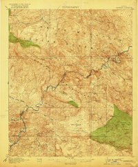
Editions of this 1910 Ray Map
3 editions found

Other maps of this area

1900 · Florence
USGS Topo · 1:125,000
1901 · Globe
USGS Topo · 1:62,500
1902 · Globe
USGS Topo · 1:62,500

1902 · Florence
USGS Topo · 1:125,000

1911 · Winkelman
USGS Topo · 1:125,000

1913 · Winkelman
USGS Topo · 1:125,000
1915 · Christmas
USGS Topo · 1:62,500
1917 · Christmas
USGS Topo · 1:62,500

1934 · Newman Peak
USGS Topo · 1:125,000
1948 · Pinal Ranch
USGS Topo · 1:24,000