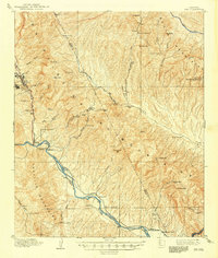
1910 Map of Ray
USGS Topo · Published 1948About this map
Ray and the neighboring community of Sonora anchor the western edge of this 1907-1908 survey, representing a period of intensive copper exploration in Pinal County. The map documents the industrial landscape before large-scale open-pit mining completely reshaped the topography, showing the Ray And Gila Valley and the Ray Hill area. To the south, the Gila River corridor serves as a vital transportation artery, where the Arizona Eastern railroad connects riverside settlements like Kelvin, Erman, and Branaman.
Find a feature on this map
63 named features on this map. Tap any name to fly to it.
Don’t see what you’re looking for? This feature index may not catch every label — zoom into the map to look around manually.
Map Details
Editions of this 1910 Ray Map
3 editions found
Other maps of this area

1900 · Florence
USGS Topo · 1:125,000

1901 · Globe
USGS Topo · 1:62,500

1902 · Globe
USGS Topo · 1:62,500

1902 · Florence
USGS Topo · 1:125,000

1910 · Ray
USGS Topo · 1:62,500

1911 · Winkelman
USGS Topo · 1:125,000

1913 · Winkelman
USGS Topo · 1:125,000

1915 · Christmas
USGS Topo · 1:62,500

1917 · Christmas
USGS Topo · 1:62,500

1934 · Newman Peak
USGS Topo · 1:125,000