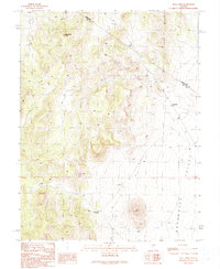
1990 Map of Bull Fork
USGS Topo · Published 1990About this map
Duckwater Peak dominates this high-altitude landscape along the border of White Pine and Nye counties. Revised from 1980s aerial photography, this provisional survey documents a transition from the elevated peaks of the interior to the broad floor of Duckwater Valley. The terrain is marked by essential water sources such as Big Louie Spring and a standalone Water Tank, supporting the sparse infrastructure in this arid region. Evidence of small-scale land use and mineral exploration appears through labels for a Borrow Pit and a Prospect located near the headwaters of the Bull Fork drainage. A network of 4 WD tracks provides the only access through these canyons, illustrating the isolation of the Great Basin interior at the close of the twentieth century.
Find a feature on this map
11 named features on this map. Tap any name to fly to it.
Don’t see what you’re looking for? This feature index may not catch every label — zoom into the map to look around manually.
Map Details
Editions of this 1990 Bull Fork Map
This is the sole edition of this map. No revisions or reprints were ever made.
Other maps of this area

1951 · Green Springs
USGS Topo · 1:62,500

1956 · Lund
USGS Topo · 1:250,000

1956 · Ely
USGS Topo · 1:250,000

1959 · Ely
USGS Topo · 1:250,000

1960 · Lund
USGS Topo · 1:250,000

1963 · Ely
USGS Topo · 1:250,000

1964 · Duckwater
USGS Topo · 1:62,500

1964 · Moody Peak
USGS Topo · 1:62,500

1968 · Brown Summit
USGS Topo · 1:24,000
1968 · Brown Summit NW
USGS Topo · 1:24,000