
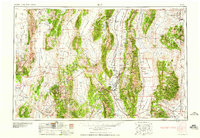
1959 Map of Ely
USGS Topo · Published 1959About this map
White Pine County and the high basins of eastern Nevada are defined by a rhythmic succession of north-south mountain ranges and expansive valleys. In the heart of this landscape, the copper mining district surrounding Ely remains the primary hub of activity, with the Nevada Northern railroad line connecting the smelter at McGill to the mines at Ruth, Kimberly, and Lane. This 1959 survey documents the region's industrial footprint alongside the fading traces of nineteenth-century silver booms. To the west, the ghost towns of the White Pine District, including Hamilton, Treasure City, Shermantown, and Eberhardt, are marked as ruins on the slopes of Mount Hamilton. These clustered settlements, once thriving mining centers, illustrate the boom-and-bust cycle of the Great Basin frontier. From the Goshute Indian Reservation in the northeast to the high reaches of Wheeler Peak in the Snake Range, the map details a landscape of isolated ranches like Thompson Ranch and Maggini Ranch scattered across vast distances.
Find a feature on this map
76 named features on this map. Tap any name to fly to it.
Don’t see what you’re looking for? This feature index may not catch every label — zoom into the map to look around manually.
Map Details
Editions of this 1959 Ely Map
2 editions found
Other maps of this area

1908 · Fish Springs
USGS Topo · 1:250,000

1910 · Fish Springs
USGS Topo · 1:250,000

1925 · Gold Hill
USGS Topo · 1:62,500

1926 · Roberts Mountains
USGS Topo · 1:250,000

1928 · Gold Hill
USGS Topo · 1:62,500

1929 · Roberts Mountains
USGS Topo · 1:250,000

1934 · Jiggs
USGS Topo · 1:125,000

1937 · Mineral Hill
USGS Topo · 1:48,000

1937 · Jiggs
USGS Topo · 1:125,000

1943 · Mineral Hill
USGS Topo · 1:62,500