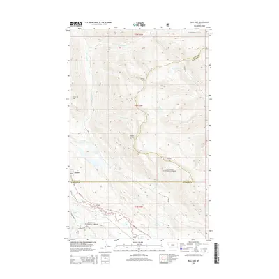
2014 Map of Bull Lake
USGS Topo · Published 2014About this map
Stryker and the prominent Point of Rocks define the settled corridor along Highway 93 N in this 2014 survey. The landscape is dominated by the steep, forested slopes of the Flathead National Forest and Kootenai National Forest, where the terrain rises sharply from the Stillwater River valley toward high points like Stryker Peak and Heerig Mtn. The river follows a winding southern course, fed by numerous alpine water bodies including Bull Lake, Sunday Lakes, and the secluded Heerig Lake. These drainage patterns, including Hellroaring Cr and Fitzsimmons Cr, have historically dictated the placement of forest development roads such as Fitzsimmons Rd and Sunday Creek Rd. This map captures the intersection of the Lincoln and Flathead county lines amidst a complex network of glacial lakes and mountain ridges.
Find a feature on this map
36 named features on this map. Tap any name to fly to it.
Don’t see what you’re looking for? This feature index may not catch every label — zoom into the map to look around manually.
Map Details
Editions of this 2014 Bull Lake Map
This is the sole edition of this map. No revisions or reprints were ever made.
Other maps of this area

1913 · Stryker
USGS Topo · 1:125,000

1916 · Stryker
USGS Topo · 1:125,000

1957 · Kalispell
USGS Topo · 1:250,000

1960 · Kalispell
USGS Topo · 1:250,000

1961 · Kalispell
USGS Topo · 1:250,000

1963 · Mount Marston
USGS Topo · 1:24,000

1963 · Stryker
USGS Topo · 1:24,000

1963 · Sunday Mountain
USGS Topo · 1:24,000
1966 · Radnor
USGS Topo · 1:24,000

1966 · Red Meadow Lake
USGS Topo · 1:24,000