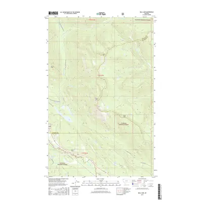
2017 Map of Bull Lake
USGS Topo · Published 2017About this map
Flathead National Forest and Kootenai National Forest converge in this high-altitude landscape of the Montana Rockies. The drainage of the Stillwater River dictates the local geography, flowing past the prominent Point of Rocks while receiving waters from Fitzsimmons Cr and Sunday Cr. This modern survey illustrates the balance between natural topography and forest management infrastructure, visible in the network of logging roads and trails that traverse the ridges.
Find a feature on this map
32 named features on this map. Tap any name to fly to it.
Don’t see what you’re looking for? This feature index may not catch every label — zoom into the map to look around manually.
Map Details
Editions of this 2017 Bull Lake Map
This is the sole edition of this map. No revisions or reprints were ever made.
Other maps of this area

1913 · Stryker
USGS Topo · 1:125,000

1916 · Stryker
USGS Topo · 1:125,000

1957 · Kalispell
USGS Topo · 1:250,000

1960 · Kalispell
USGS Topo · 1:250,000

1961 · Kalispell
USGS Topo · 1:250,000

1963 · Mount Marston
USGS Topo · 1:24,000

1963 · Stryker
USGS Topo · 1:24,000

1963 · Sunday Mountain
USGS Topo · 1:24,000
1966 · Radnor
USGS Topo · 1:24,000

1966 · Red Meadow Lake
USGS Topo · 1:24,000