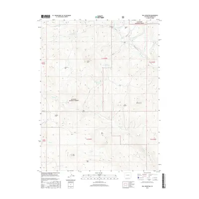
2016 Map of Bull Mountain
USGS Topo · Published 2016About this map
Gunnison National Forest dominates this high-altitude landscape in western Colorado, where drainage systems from several peaks converge. The terrain is defined by dramatic relief, rising from drainage basins like Bark Basin and The Narrows toward prominent elevations such as Bull Mountain and Ragged Mtn. Water management is evident through high-country storage at Aspen Leaf Reservoir and Ault Reservoir, which capture runoff from Ault Cr and Sheep Cr. This 2016 survey documents the complex network of mountain waters, including the headwaters of the W Muddy Cr and E Muddy Cr. Unique local nomenclature is found in the western portion of the map, specifically around the Condemn It Trail and Condemn It Park, which sit north of Pilot Knob. The map also illustrates the transition from forested slopes to high-elevation flats like Buck Mesa and Sheep Park, providing a record of the remote back-country geography of Gunnison County.
Find a feature on this map
38 named features on this map. Tap any name to fly to it.
Don’t see what you’re looking for? This feature index may not catch every label — zoom into the map to look around manually.
Map Details
Editions of this 2016 Bull Mountain Map
This is the sole edition of this map. No revisions or reprints were ever made.
Other maps of this area

1938 · Mt. Gunnison
USGS Topo · 1:48,000

1945 · Mount Gunnison
USGS Topo · 1:62,500

1956 · Montrose
USGS Topo · 1:250,000

1957 · Leadville
USGS Topo · 1:250,000

1959 · Leadville
USGS Topo · 1:250,000

1959 · Montrose
USGS Topo · 1:250,000

1960 · Leadville
USGS Topo · 1:250,000

1960 · Montrose
USGS Topo · 1:250,000

1961 · Electric Mountain
USGS Topo · 1:24,000

1961 · Spruce Mountain
USGS Topo · 1:24,000