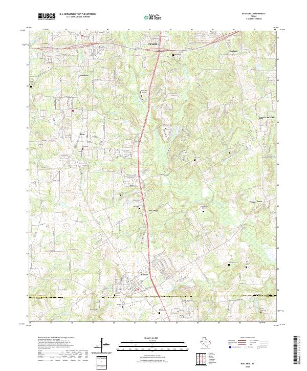
2022 Map of Bullard
USGS Topo · Published 2022About this map
Bullard and its surrounding communities are mapped here during a period of sustained suburban growth south of Tyler. The landscape is a complex network of small settlements like Flint, Gresham, and Walnut Grove, many of which maintain their historical identities through local landmarks and family burial grounds. The geography is defined by the headwaters of numerous creeks, including Shackleford Cr and W Mud Cr, which carve through the terrain between the modern corridors of W Loop 49 and FM 2493.
Find a feature on this map
47 named features on this map. Tap any name to fly to it.
Don’t see what you’re looking for? This feature index may not catch every label — zoom into the map to look around manually.
Map Details
Editions of this 2022 Bullard Map
This is the sole edition of this map. No revisions or reprints were ever made.
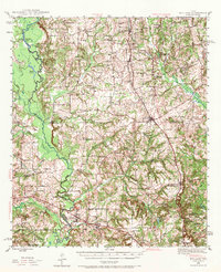
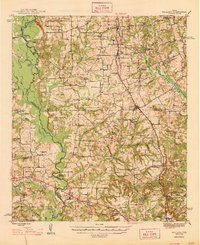
Historical Maps of Tyler Through Time
4 maps found