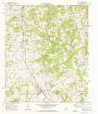
1973 Map of Bullard
USGS Topo · Published 1977About this map
The St Louis Southwestern railway corridor anchors this 1970s landscape, running south through Gresham and Flint to the community of Bullard. This area of East Texas is characterized by a dense network of small rural settlements and family-named landmarks, reflecting a deep-rooted agricultural and residential history. Numerous country churches like New Bethel Ch and Mount Zion Ch are scattered across the terrain, often located near local burial grounds such as Barron Cem and the Crow Cem.
Find a feature on this map
40 named features on this map. Tap any name to fly to it.
Don’t see what you’re looking for? This feature index may not catch every label — zoom into the map to look around manually.
Map Details
Editions of this 1973 Bullard Map
This is the sole edition of this map. No revisions or reprints were ever made.
Other maps of this area

1937 · Troupe
USGS Topo · 1:48,000

1938 · Winona
USGS Topo · 1:48,000

1943 · Troup
USGS Topo · 1:62,500

1943 · Winona
USGS Topo · 1:62,500

1946 · Bullard
USGS Topo · 1:62,500

1948 · Bullard
USGS Topo · 1:62,500

1948 · Tyler
USGS Topo · 1:62,500

1949 · Tyler
USGS Topo · 1:62,500

1956 · Tyler
USGS Topo · 1:250,000

1966 · Chandler
USGS Topo · 1:24,000