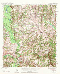
1946 Map of Bullard
USGS Topo · Published 1970About this map
Bullard and the surrounding piney woods of East Texas are defined by a network of rural communities and early transportation corridors during the mid-1940s. The landscape is anchored by the Neches River, which winds along the western border, feeding into Big Eddy Lake and Flag Lakes. This survey captures the region just before significant postwar modernization, showing the reliance on the St Louis Southwestern and Southern Pacific railroads to connect towns like Flint and Mount Selman.
Find a feature on this map
51 named features on this map. Tap any name to fly to it.
Don’t see what you’re looking for? This feature index may not catch every label — zoom into the map to look around manually.
Map Details
Editions of this 1946 Bullard Map
2 editions found
Other maps of this area

1937 · Troupe
USGS Topo · 1:48,000

1938 · Winona
USGS Topo · 1:48,000

1943 · Troup
USGS Topo · 1:62,500

1943 · Winona
USGS Topo · 1:62,500

1943 · Rusk
USGS Topo · 1:62,500

1945 · Rusk
USGS Topo · 1:62,500

1946 · Bullard
USGS Topo · 1:62,500

1948 · Bullard
USGS Topo · 1:62,500

1948 · Tyler
USGS Topo · 1:62,500

1948 · Brownsboro
USGS Topo · 1:62,500