
1945 Map of Rusk
USGS Topo · Published 1945About this map
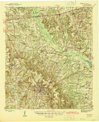
Rusk serves as the central hub of this East Texas landscape, where the confluence of the Southern Pacific and Missouri Pacific railroads defines the regional economy. Beyond the town grid, which includes the Rusk State Hospital and Dickey Lake, the terrain is marked by a dense network of rural communities such as Dialville, Gallatin, and Ponta. The map reveals a deeply settled agricultural and timber countryside, evidenced by the high frequency of family-named landmarks and local institutions like Henry Cem, Bagley Chapel, and Afton Grove Sch. To the east, Mud Creek and its many tributaries, including Sweet Gum Creek and Falcon Creek, snake through the hills toward the Angelina River. This 1940s survey documents a moment when local schools like Iron Hill Sch and Atoy Sch still dotted the crossroads, anchoring small settlements that define the genealogy of Cherokee County.
Find a feature on this map
60 named features on this map. Tap any name to fly to it.
Don’t see what you’re looking for? This feature index may not catch every label — zoom into the map to look around manually.
Map Details
Editions of this 1945 Rusk Map
2 editions found
Other maps of this area

1935 · Henderson
USGS Topo · 1:48,000

1937 · Troupe
USGS Topo · 1:48,000

1939 · Henderson
USGS Topo · 1:62,500

1943 · Troup
USGS Topo · 1:62,500

1943 · Cushing
USGS Topo · 1:62,500

1943 · Rusk
USGS Topo · 1:62,500

1945 · Cushing
USGS Topo · 1:62,500

1946 · Alto
USGS Topo · 1:62,500

1946 · Bullard
USGS Topo · 1:62,500

1948 · Bullard
USGS Topo · 1:62,500