
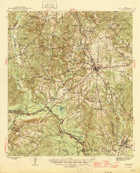
1946 Map of Alto
USGS Topo · Published 1946About this map
Alto serves as the focal point of this mid-1940s landscape, where the St Louis Southwestern RR intersects with ancient travel corridors like the Old San Antonio Road and El Camino Real. The terrain is defined by the winding course of the Neches River, which forms the boundary between Cherokee Co and Houston Co. This river system creates a complex network of backwaters and sloughs, including Pearman Lake, Duren Lake, and the evocative The Whirl.
Find a feature on this map
88 named features on this map. Tap any name to fly to it.
Don’t see what you’re looking for? This feature index may not catch every label — zoom into the map to look around manually.
Map Details
Editions of this 1946 Alto Map
2 editions found
Other maps of this area

1943 · Cushing
USGS Topo · 1:62,500

1943 · Rusk
USGS Topo · 1:62,500

1945 · Cushing
USGS Topo · 1:62,500

1945 · Rusk
USGS Topo · 1:62,500

1950 · Crockett NE
USGS Topo · 1:24,000

1950 · Kennard NE
USGS Topo · 1:24,000

1950 · Ratcliff
USGS Topo · 1:24,000

1951 · Wells
USGS Topo · 1:24,000

1951 · Crockett NE
USGS Topo · 1:24,000

1951 · Kennard NE
USGS Topo · 1:24,000