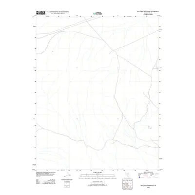
2012 Map of Bullfrog Mountain
USGS Topo · Published 2012About this map
Bullfrog Mountain dominates the southeastern corner of this arid landscape in Nye County, Nevada. This region is characterized by a sparse network of local roads and unimproved trails that traverse the desert floor and ascend the surrounding slopes. The mapping reveals a rugged basin-and-range topography where natural drainages are primarily ephemeral washes, suggesting a landscape shaped by seasonal water flow in an otherwise dry environment. The scarcity of named landmarks or permanent settlements in this sector emphasizes the remote and undeveloped nature of the terrain during the early 21st century. Researchers and hikers can use the topographic detail to trace the connectivity of high-desert pathways as they existed in this specific period of the Great Basin's history.
Find a feature on this map
1 named feature on this map. Tap any name to fly to it.
Don’t see what you’re looking for? This feature index may not catch every label — zoom into the map to look around manually.
Map Details
Editions of this 2012 Bullfrog Mountain Map
This is the sole edition of this map. No revisions or reprints were ever made.
Other maps of this area

1908 · Kawich
USGS Topo · 1:250,000

1908 · Lida
USGS Topo · 1:250,000

1908 · Furnace Creek
USGS Topo · 1:250,000

1908 · Ballarat
USGS Topo · 1:250,000

1910 · Furnace Creek
USGS Topo · 1:250,000

1913 · Lida
USGS Topo · 1:250,000

1913 · Ballarat
USGS Topo · 1:250,000

1942 · Tolicha Peak
USGS Topo · 1:125,000

1942 · Bullfrog
USGS Topo · 1:125,000

1948 · Death Valley
USGS Topo · 1:250,000