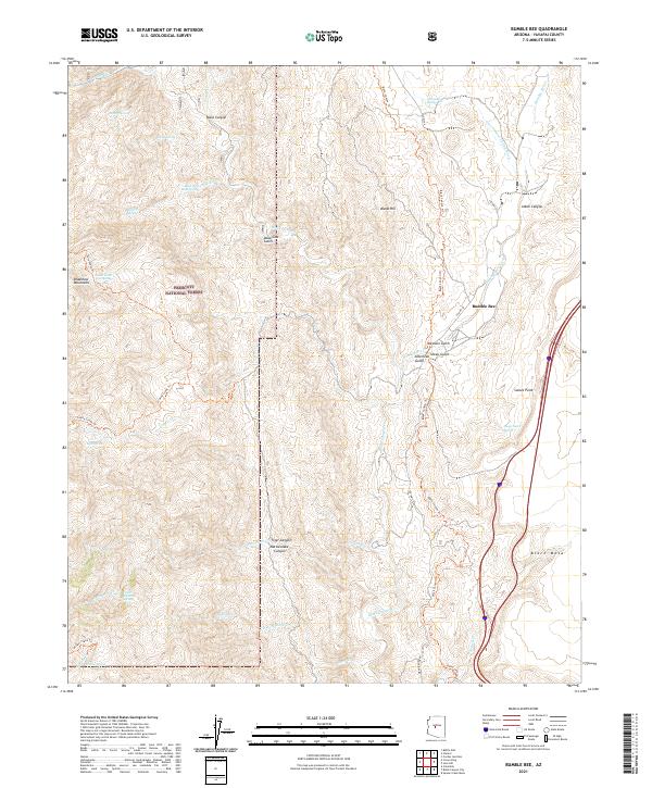
2021 Map of Bumble Bee
USGS Topo · Published 2021About this map
Bumble Bee sits at the heart of this Yavapai County landscape, where the high desert meets the southern reaches of the Bradshaw Mountains. The terrain is deeply incised by a network of drainage systems, most notably Black Canyon and its namesake Black Canyon Cr, which dictate the movement of both modern travelers and those on the historical Black Canyon Trl. The presence of Bill Arp Mine Spring and Maggie Mine Rd points to the area's prospecting history, while the vast acreage of the Prescott National Forest preserves the transition from the arid flats of Black Mesa to the high ridges of Bland Hill. Settlement is sparse, concentrated at the historic stage stop area of Bumble Bee and the overlook at Sunset Point, reflecting a landscape defined more by its geology and seasonal water sources like Sheep Gulch Spring than by urban expansion.
Find a feature on this map
49 named features on this map. Tap any name to fly to it.
Don’t see what you’re looking for? This feature index may not catch every label — zoom into the map to look around manually.
Map Details
Editions of this 2021 Bumble Bee Map
This is the sole edition of this map. No revisions or reprints were ever made.
Other maps of this area

1887 · Prescott
USGS Topo · 1:250,000

1892 · Prescott
USGS Topo · 1:250,000

1903 · Bradshaw Mountains
USGS Topo · 1:125,000

1947 · Crown King
USGS Topo · 1:62,500

1947 · Bumblebee
USGS Topo · 1:62,500

1947 · Mayer
USGS Topo · 1:62,500

1947 · Mt. Union
USGS Topo · 1:62,500

1948 · Bumblebee
USGS Topo · 1:63,360

1948 · Crown King
USGS Topo · 1:63,360

1948 · Mt. Union
USGS Topo · 1:63,360